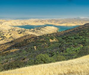
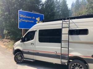
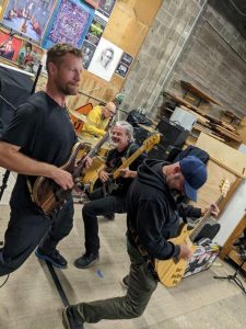
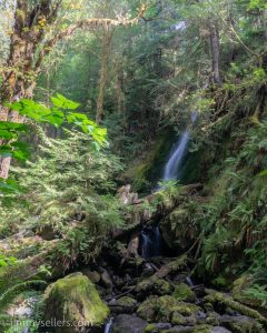
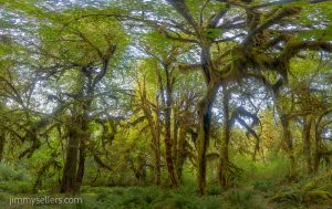
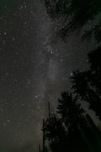
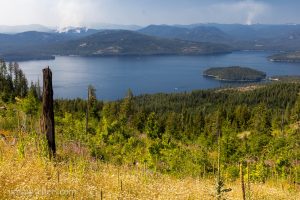
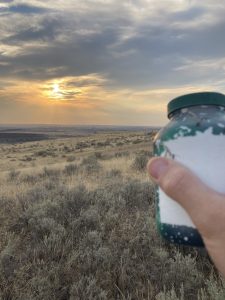
Yosemite! I love it so much it’s my tire cover picture

Day 48:
Today I met Roald, hands-down the coolest dog of my trip.
11,850 miles in counting.
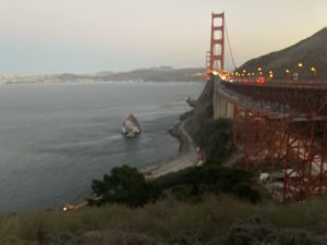
I woke up at the Golden Gate Bridge rest area this morning. That’s two mornings in a row I woke up at the Golden Gate Bridge, nothing to complain about, I guess. Yesterday was such a fun and successful day, and completely unexpected for the things that I have planned, that I slept better, as long as my body would allow me. I woke up to the sun high in the sky, got cleaned up and got moving. The only thing certain is I have a campground reservation in Yosemite starting today, through the next few days until my van repairs on Thursday.
I toil with what to do and where to go and what route to take to get to Yosemite. Like every other day of this trip, I have changed my mind 100 times in 20 minutes. Originally, I wanted to go back and visit Jeremiahs Gold again. That final is going to haunt me forever, unless I find it. But I think I decided to head out towards Bodie and then work my way into Yosemite from the other side.
I drove East all day. The most beautiful area being Lake Tahoe, obviously. The weather was perfect, and the skies cooperated for me to get some of the most amazing views from above, down onto the lake.
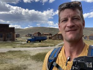
My first real stop of the day was Bodie California. Bodie is an abandoned mining town, that CA maintains as a park. I made it out there about mid-day. I spent a couple hours wandering around, taking pictures, being unbelievably fascinated about this time period. This kind of stuff has always fascinated me. I know I say if I had one I wish, I’d lived back then, I’m wrong. But I wish I could travel back in time for a vacation. you know, kind of like a dude ranch? West World style. If anyone has connections with robots and AI, get in touch.
Since I was driving right past, I had to make a stop at Mono Lake on the way from Bodie to Yosemite. I first heard a mono lake in 2013, the first time I visited Yosemite. But I’ve never been here. Glad I made a little pitstop, it was the perfect time of day. The sun was behind everything and casting that beautiful “sun is setting” light.
Now into Yosemite where I will make my home for the next few days. I’m killing time, and giving my van a rest, before hopeful repairs on Thursday in Sacramento. I guess I just called 3 days in Yosemite “killing time”. More examples I’m the luckiest person alive. I’ve never driven over Tioga Pass before, I don’t believe. I’ve been to Yosemite a few times, but don’t think I ever left the park on the eastern side. That’s one of the more unbelievable passes I’ve ever passed through. I pulled over so many times to look and take pictures I lost count.
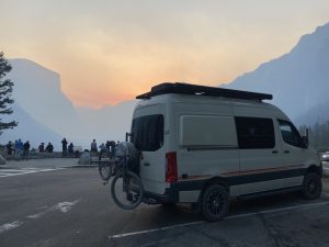
I love Yosemite so much. I saw a big brown bear wandering around shortly after I entered the park. Also, it’s the only place where I can enter the gates and think to myself
“Yay I’m in Yosemite!” And then I still have a 2 Hour drive to get to where I’m going in the valley.
What a great place.

Day 49:
Today I met Pierre or PeePee as he is affectionately known, hands-down the coolest dog of my trip.
12,270 and counting.
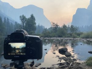
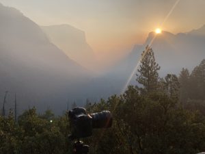
I woke up in a Yosemite valley campsite this morning. There won’t be a lot of miles today, because I’m in Yosemite and may not even move my little girl. I got up at about five and drove out to Valley View for sunrise pictures. It was a bit hazy, understandably. But beautiful for all the right reasons. Then up to Tunnel View. I watched the sun come up over the mountain and took some pictures. What an unbelievable life I have. I made conversation with lots of other traveling strangers. It was an amazing way to start my day. Then back to camp where I made myself a wonderful bacon and eggs and fruit breakfast. I think that’s the first time I’ve actually “cooked” a meal in my van. I’ve made a lot of boil in bags, sandwiches, dry foods. But I broke out the cooktop and whipped up some eggs and bacon.
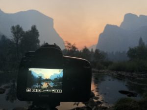
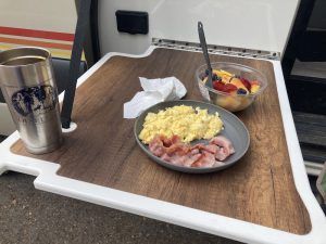
My possible plan for today is to at least make a big walking loop around the valley. I can’t believe there’s still so many geocaches I haven’t found in Yosemite? I’ve been here twice before, both times since I started Geocaching. But there are just a whole lot of unfound geocaches. Lots of them found, but way more than should be unfound.
The way I had to get campsites in here is strange, but I’m just grateful to have them at all. I was in one spot for one night and then the next morning I had to move a quarter-mile to another site for the next two nights.
I did about an 8-mile walking loop around the valley. I got back in the perfect time to move my van from one site to the other. I still cannot believe there are so many geocaches that I had not found in two prior visits here. I walked a big loop. It was about 8 miles, a couple virtuals, whereIgo, very unique question mark in the middle of a national park, and earth caches of course. I had to move my mobile home from one campsite over to campsite number 69 in upper Pines. Hee hee.
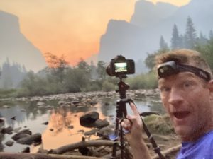
I slung up my hammock and rested for a while, just taking in the sky. At the time of day when the sun was highest in the sky, a sunshower came through. Bright blue in one direction, and terrifying gray in the other. The drops were as big as quarters, they felt great in the blazing sun, and that smell of the ozone in a thunderstorm in the trees is delightful.
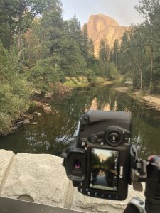
I finished the night with pictures on the famous bridge that looks into the valley. I set up there a good two hours before I needed to. That gave me the opportunity to have at least a dozen wonderful and meaningful conversations. Most notably I met the most fascinating person so far of the trip. A young fellow from New Jersey named CJ. He’s an inspiration to what we can be.
Then it was back to the campsite. I made a steak and mashed potatoes, and went to bed for the night.

Day 50:
Today I met Ozzy, hands-down the coolest dog of my trip.
12300 miles and counting.
I woke up in Yosemite Valley, campsite #69. Coolest part of the trip so far.
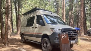
I had nothing planned. I had to drop my van off for service in Sacramento in 24 hours, so I had that long to play. I made myself a lovely breakfast at the campsite, eggs and bacon. I turned my back for 5 seconds to get my water and walk it to the picnic table, and a crow stole all 4 pieces of my bacon. That left me very depressed. Thankfully the delicious cheesy eggs fixed everything. I spent a while wandering around the campground, enjoying the sounds and smells, and chatting with tons of strangers. About mid-morning, I wrapped up everything, packed up nothing, and got on the road. I had a hike I wanted to do in Yosemite before I left. I parked at Tunnel View, and hiked straight up the side of the mountain, toward Glacier Point. Glacier Point is about 13 miles straight up. I only went about 2 up, almost 4 miles round trip. I found this awesome and old virtual geocache there. Thanks for brining me to this hike. Sadly, the haze was really bad today, and the views were all silhouetted outlines. Still amazing in its own, but different way.
From the park, it was time to get to Sacramento, I had a bed in a hotel waiting for me there. I took my time driving, enjoying the scenery along the Merced River. No picture opportunities today, sadly. I made it into the city, got Pervvie to a nearby truck wash, picked up some stuff at an amazon locker at a 7-11, stopped at the auto depot for more Pervvie liquids (she loves the green stuff), and finally checked into my hotel. Tomorrow morning I take my baby to the infirmary to hopefully find out what ails her.

I did start an album of this trip that I am updating as I process. HERE.
On to San Francisco, the Golden Gate Bridge, and a Phillies game

Day 45:
Today I met Xavier, or just X, hands-down the coolest dog of my trip.
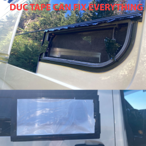
I checked into and woke up at a hotel in Davis this morning. Not much geocaching will happen today. I need to catch up on real life work, obligations, and process through some of the pictures I have taken. I had to drop my van, Pervvie, off at La Mesa for a window replacement. I got her there 1st thing, and they were done by 11am. Amazing. I spent most of the day in front of the computer, but when I did venture out, I found a super cute doggie geocache, and I failed at 1 multi cache. Hopefully I will rectify that tomorrow. I did get a lot of other things accomplished today, including a nice chunk of catch up work.

Day 46:
11,700 miles and counting.
This is the day I checked out of the hotel in Davis California. I spent most of the morning and early afternoon doing computer stuff, pictures, blog etc. I have weeks worth of picture processing to catch up on, and I got a nice hunk done. On the way out of town I made a point to find some highly favorited and important geocaches.
My intent is to make it to the Napa old one, and then hopefully sleep at the Golden Gate Bridge. I started my day at a graveyard I finished my day at yesterday. I was wrapping up a multicache. Thank you to the CO for leading a blind guy in the dark. Are these wild turkeys always here because they feast on corpses?
I made out OK on my way out of the town of Davis. I spent a few hours navigating around a completely empty college town. It was the perfect day to drive wherever I want, whenever I want, and park anywhere I want. I found most everything I look for, but had a few disappointing DNF’s as well. Now I’m headed toward San Fran, with a stop in Napa.
My time in Napa went perfectly as planned. I jogged part of the way out, and all the way back, after finding the old ones along the skyline Ridge Trail. When I finished my jog back near parking, I had enough sunlight to do the multi nearby. That one was a lot of fun and very cute.
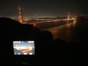
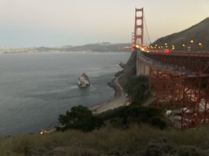
After that I started heading towards the ocean. It’s impossible to drive directly west at sunset, so I pulled over and had a pizza and some Dr Pepper. From there I drove to the Golden Gate Bridge and scouted out different overlooks. I found the perfect one and pulled in there for the evening. I took pictures throughout the night of a lit up Golden Gate Bridge. I then woke up pre-sunrise and got ready to take pictures first thing in the morning of the sun rising over/under the Golden Gate Bridge. Everything went perfectly. That pull off I slept at is a bit of a rowdy party area. Those kids, am I right?

Day 47:
11,800 miles and counting.
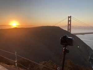
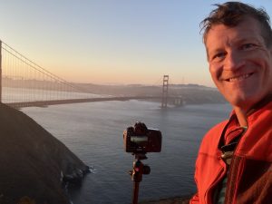
I woke up overlooking the Golden Gate Bridge. I took pictures of the bridge in the middle of the night and then woke up in time to catch pre-sunrise and sunrise at the Golden Gate Bridge. Everything went perfect.
Now my hope is to go into San Francisco proper and bebop around there for a while on a Sunday, before a Labor Day holiday. My hopes are the city will be abandoned and empty.
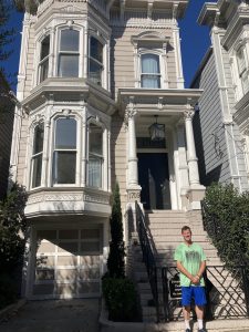
Immediately after sunrise I headed to San Francisco proper. I was going to come into the city and drive around until it aggravated me to no end, and I had to split. But I at least had to get started. It was so early and a Sunday and a holiday weekend I assumed that I had the whole place to myself. I started in one area of the most favorited geocaches, mixed in with some personal ones I wanted to find for personal reasons. Obviously I had to take my picture in front of the Fuller House. After that I parked at the marina. I hopped on my bike. I knocked off another five or six fun things in another cluster on the map, by bike. I was really on a roll. It was about that time when I needed to head to the piers, the busy place, the place that terrifies me. I checked if there was a baseball game. There was, and the local ball club was playing the Phillies. I don’t like baseball, but where I come from, everyone roots for the Phillies. I knew I had to go to this game, just to piss off people at home. They already hate me for this road trip. Now they can hate me b/c I saw their team play in San Fran. But then I decided not to do that, I would just keep navigating the city by van.
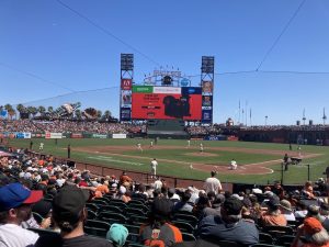
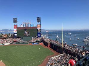
For what I think is the third time in this adventure, my wife has come to the rescue. Because of my go go go, I have to get things accomplished attitude and actions, I don’t do a lot of stopping and smelling the roses. I had this unbelievable opportunity dropped in my lap. I knew I wanted to walk around in San Fran. My wife told me I simply had to go to the ball game. So, I went back to my van, took a shower in the middle of a parking lot in the middle of San Francisco, put on 100% clean clothes for the first time in days, and I caught an Uber to the ball field. Wouldn’t you know my luck, I buy a ticket from a scalper off the street, and I still end up in the luxury club box area. So, I enjoy a nice gourmet lunch, then go out and sit through a few innings in the heat. Make really nice conversation with the old fella next to me. Then I wander the entire stadium top to bottom left to right, just to see what a baseball field is.
I got all my obligatory pictures and I moved on. Out front to the Willie Mays Hayes statue and then to start a walking journey around town.
I was looking at where I want to be on a map and thinking, I can’t do all that walking. That’s miles and miles of walking. I walk miles and miles and miles all the time. The difference is here I’m scared because it’s a city. It is safe to say that walking might be my favorite thing. It is also safe to say that cities are my least favorite thing. but I do know from historical fact that I can meet those 2 things in the middle, and have a glorious day. Everything will be paved? There’s no sticker bushes or wild animals going to try to kill me? Sounds like the perfect walking conditions, and for some reason I was still hesitant to walk 8 miles.
Even sometimes my idiocy amazes me as much as it does my wife.
Between the food and the Cheebah, San Francisco is the best smelling town I have visited so far.
I did so many amazing geocaches, visited so many amazing places for art, history, and fun, and got a lot of steps in. I almost robbed myself of that, because I am a laser focused buffoon.
I walked myself all the way back to the van, and took myself to the vista point off 101 at the GGB. That is where I will spend the night, and tomorrow will start to venture toward Yosemite for a few nights.

I did start an album of this trip that I am updating as I process. HERE.
Jimmy vs Jeremiah’s Gold: The Squeakquel

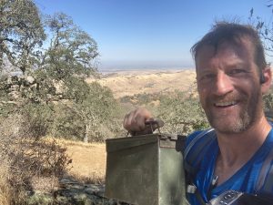
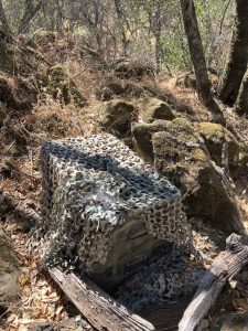
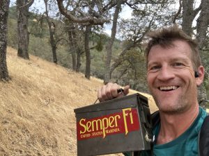
The mission was simple, I’ve done it 1000 times. Actually, now I have done that 10 times. I put all my best hiking gear on, filled my backpack full of water and camera equipment, go for a hike, find a very specific geocache, and any others that fall along that hiking route. Not too complicated. Something that is right in my wheelhouse. Recently, in some foothills near San Francisco, I thought I met my match. I went to Morgan Territorial Regional Preserve to find a geocache dating back to the year 2000. One of the oldest in the country, probably the world. It was going to be a few mile hike round-trip. There were several other geocaches along that route, so I knew they would get my whole attention. I was moving right along, minding my own business, and Jeremiah shows up in my life. It is an entire series that culminates in a final puzzle, put out by a young brother that runs by the name of Jesse. Very little I like more than a puzzle. I did like all these ammo boxes that were lugged up here. 1 was the size of a coffin. Others were the size of a really big ammo box. And yet another was so big it had to come in by copter.
There were six or seven, each with a hint on where to find the final. I found one and immediately dismissed the bigger picture. It was just a traditional geocache I found, great, plus one for me. Then I found a second one. I thought to myself, I better take a look at this. So, I found one of the four spots of shade in the county, and I sat down for a few minutes to figure it out. The route I was taking to my ultimate goal, if I veered off of that just a little bit and doubled my original plan, I can get all of these! That’s not bad. doubling only goes from 3 to 6 miles, or something like that. Still no big deal. I decide that’s what I’m doing. I even study the Geocaching map and notice an empty area where I am hoping the final will be. That would mean it was put there strategically so that you could do this loop and wind up back at the final on the way back to wherever you parked. I got to about the fourth or fifth one and realized I had went the wrong way. I look to my right and realized I had to be 500 feet above where I was right now, almost straight up. I missed the turn to walk along the ridge line. I thought to myself OK, I wasn’t meant to find Jeremiah‘s gold anyway. I didn’t know about it until a few hours ago, I can’t be too disappointed.
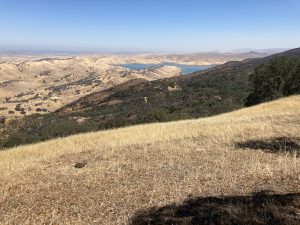
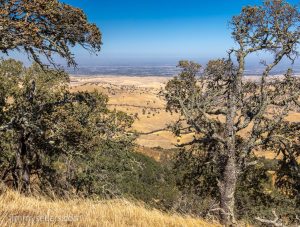
I just had to accept the fact that this is where my quest for the gold ended. About 10 minutes later I kicked myself in the ass and said no, I got to do this. I walked backwards adding about another mile of uphill walking to get back to the ridge line. And then I walked along the most spectacular ridge line, stellar views, and some of the most unique trees I’ve ever seen growing out of rocks. If for no other reason I’m glad I double back for that. So, I was back on track! I had already completed the task that brought me here, now I was 80% of the way to a new bigger, even better task. I find the last geocache with the clue in it. I find one of those other spots of shade. I sit down and put the puzzle pieces together. I plug-in the coordinate numbers of where this geocache wants me to be. Oh bother. It is all the way back past even the farthest point I was all day.
On a normal day, that would be no problem. But this was a different kind of hot desert hiking that I wasn’t used to. It was over 100°. Completely exposed, no shade. I’m used to hiking in trees and forests. And earlier today I had put on another 15 or so miles of hiking. So I’m tired. It is rare that it happens to me, but I was completely wiped out and couldn’t do anymore.
I barely slept for the next few nights. All I could think about was not completing the task that I didn’t even know I had. Tossing, turning, lashing out at strangers, breaking things that I haven’t paid for yet, just a wreck of a human. I can’t believe how close I came to Jeremiahs gold, and it slipped away from me. I should’ve just grit my teeth and walked back. But I did not.
Sometime shortly after that, the young gentleman that owns these geocaches, and my new best penpal in the world, Jesse wrote to me to say hello, and that he was happy I had a great time finding all his geocaches, all the things that I would want to hear. Jesse went so far as to offer me a free “find” on the final puzzle. Quoting Jesse in his original communication with me, “Dr. Sellers: You seem really cool. Please help yourself to a find on the final puzzle, based on handsomeness alone.”
I was so flattered, but I knew I could not take that. I have cheated plenty in GC’ing, but only in the ways we all agree is OK. Plus, in the back of my mind, I thought I might still go back another day. I was going to be in the “area” for a bit longer. But I knew that was ridiculous to drive hours out of my way to do a hike I already did, but I’m not on any real itinerary.
It is very well known by my friends and family that I will go way out of my way, do almost anything, just to make 1 person laugh. I’ve done things like drive 12 extra hours, buy domain names, spend too much money, lie cheat steal, whatever it takes to make someone laugh or smile. My specialty is overdoing it for 1 person. I thought to myself, if I went way out of my way just find this one geocache, I bet that would make Jesse smile. But I just couldn’t fit it into my busy schedule. My calendar was wide open with nowhere to be any particular time at all. The one day I was going to go, I’m glad I didn’t. I have nothing but respect for Jesse. But I ended up having an amazing day in San Francisco. I did a walking tour, smelling the smells, and I even took in a baseball game. I had to because my Phillies were in town. I just kept meandering around the San Francisco area for different reasons a lot longer than I expected. Take pictures of the Golden Gate bridge sunrise one morning, middle of the night the next day.
Finally, I was done with San Fran/Sacramento area, and I’m heading to the PCH to pick my road trip back up! And wouldn’t you know, the optimal route to get from Sacramento to Monterey includes Morgan Territory Road! I had to do it, and I better take a picture because people are gonna think I’m a liar and a cheater. Mainly because I am 100% a liar and a cheater
Finally, the day came. It was 9 days after my initial discovery of Jeremiah’s Gold. These were days 44 and 53 of this mad road trip. I’m so glad I did not throw away those shoes and socks. They are definitely gone after today though. I took off walking after packing up my water and needed supplies. It is a very well defined trail system, easy to navigate. VERY up and down, lots of quick elevation. I jogged everywhere it was downhill or flat-ish. All in all, it only took me two hours round-trip. I got a message from Jesse later saying that I made his day and maybe even his year. Since then, Jesse and I have become best friends. I believe I am now godfather to his imaginary children. And I have even named him executor of my upcoming will.
I just love the amazing things that I accidentally get myself involved in, mainly because I try to leave myself open to all the nonsense.

I did start an album of this trip that I am updating as I process. HERE.
I drove all the way across CA, to drive back across CA

Day 40:
Today I met Sandy, hands-down the coolest dog of my trip.
I woke up in the most perfect location after sleeping along the PCH. I got up, rub my eyes, stretched, brush my teeth and got ready for another day. I wasn’t sure where I was heading yet, but once I started looking and thinking about it my brain was racked with decisions and choices. I think I changed my plan 100 times over the course of 30 minutes. I even turned around from where I was heading , and then re-turned back around around. I know I have to land in the northeast corner of California at some point. That’s about six hours from where I was. So, I think right now my plan is to head there, backtrack, hopefully for the night at Crater Lake, and then back out to the coastline immediately after that.
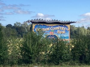
Everything turned out as planned, even better actually. I left the coast and head inland. I passed through Veneta Oregon. Home of the Oregon country fair. I’m an East Coast person, but that fair holds a lot of amazing memories of my adolescence. I used to spend two weeks each year out here with friends in Eugene, around the country fair. I did that for four or five of my most formative life years. I had to stop in. Luckily there were a couple of geocaches that brought me exactly where I wanted to be. I think the best memory I now have of the Oregon country fair is driving my van all over the empty fairgrounds, at the end of August, a month after the fair. Seeing all the permanent hippie dippy structures and signs, with nothing else around or nobody else around, that’s a memory I’ll have forever. It put a giant smile on my face and still has me giggling.
Vitreous here I come. Most of the morning I drove through the forest of southern Oregon making my way to Northeastern California. Vitreous falls into the category of things I’m looking for on this trip. Only by one single day, but it made the list.
I pulled up to the diesel pump and parked next to this guy with unbelievable log cabin on a pick-up style RV. We got to chatting and he said “I guess we’re heading to the same place?”
I thought quickly. I’m driving about 14 hours out of the way to find one geocache from the year 2000, so I doubt it. But I simply answered, “Doubt it, where are you heading?”
Burning Man he said. OK now maybe I’m going to burning man for a day. I found out later, the guy I met buying diesel is a bit of an internet celebrity: Truck House Life https://www.youtube.com/c/TruckHouseLife
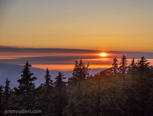
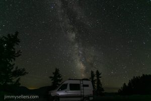
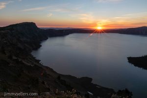
I made great time and found Vitreous and one of it’s neighbors. I chatted with some ladies that were finding obsidian ‘needles’. I got an interesting education about that. Then it was time to boogie toward Crater Lake. I made everything in perfect timing somehow. As I got into the park and did the ring road, the sun was setting. Every corner presented a new sunset view. It might be the most epic sunset I have ever seen. I shot it from many angles. Then I found a pull off to call home. The sky is crystal clear. I parked, ate, and got my camera set up in perfect time to catch the galactic band passing by. So unbelievably amazing.
I set up camp and had a giant pull off all to myself all night. It was a perfect southwest facing view. I was able to photograph the stars in the Milky Way and the galactic band all night with crater Lake as the foreground. It was hypnotic and mesmerizing.

Day 41:
10,700 miles and counting
I woke up in crater Lake this morning. I have no idea how I got here, but I’m sure glad I was here. I got here just before sunset last night. So, I had to race around and take photographs from different angles before I lost the good light. Then I set up camp and had a giant pull off all to myself all night. It was a perfect southwest facing view. I was able to photograph the stars in the Milky Way and the galactic band all night with crater Lake as the foreground. It was absolutely hypnotic and mesmerizing.
When I say I woke up in crater Lake, I was awake most of the night taking pictures. But I had to be ready for the sunrise. I was! I made it around to the other side of the lake around 6 AM to catch the sunrise pictures from there. After that was done, I then took the time to drive the rim Road and investigate each of the virtual and earth caches around the lake.
After all those tasks were complete it was time to clean up for the day and make my way back to the coast. I spent all day yesterday driving from the PCH, inland, to Northeastern California, just to turn around today and head back to the PCH to continue my journey south on that.
Crescent City is where I will pick up the PCH again. I will travel south from there, hopefully stopping around Eureka. I have a very old, dear friend that lives there. He used to be the front man of a very famous rock and roll band back in the 90s. I don’t want to say much more and give away this persons location.
I continued south, keeping the ocean on my right for the entire afternoon. I had to be in Arcata around six. I leisurely drove and stopped for random tourist options, and mostly non-traditional geocaches.
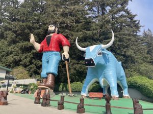
Boy those redwoods sure are impressive.
I caught up with an old friend for a few hours, had a blast, more fun than I deserve. It almost makes me wish I could live a normal life. Then it was to a nearby community center and tuck myself in for the night.

Here is my longest and probably best time lapse so far. Around 400 images:

I did start an album of this trip that I am updating as I process. HERE.
I’m a 71 year old Goonie

Day 38:
Today I met Reggie, hands-down the coolest dog of my trip.
miles and counting.

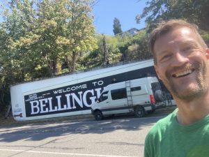
I woke up in a hotel in Bellingham, and soon departed for Astoria.
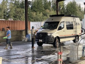
After getting very little accomplished in the last two days, and being grounded at a hotel in Bellingham, I am back on the open roads. I got a start early in the morning. Before I left town, I filled Pervvie up with her favorite liquid diesel, topped off her freshwater tank, and found a truck wash where a couple of enthusiastic young men really gave her a great bath. They did not forget her undercarriage. They really gave her undercarriage the business. I haven’t been in a clean rig in weeks now. So refreshing.
Time to start heading south with today’s destination to be Astoria.
I traveled south on the interstate 5 corridor, only stopping for tinkle breaks and a few of the highly favorited geocaches.
Thanks to that I got to see some really fun and funny things. I spent about 45 minutes hanging out inside of a bathroom. While that’s not unusual for me, as my friends and lovers will testify, it’s rarely that I have to figure out how to escape one.
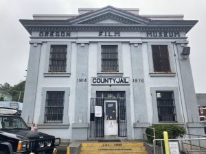
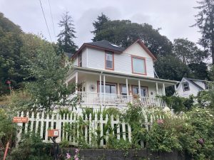
I got myself to Astoria safely, and did all the things that a little Goonie baby should.
I wandered around Astoria for a few hours. I had a burger, fries and a malt at the Custard King, because it’s 1968. After that it was time to get out to the coastline and start heading south. A couple of stops I wanted to make were also stops for the Goonies Adventure Lab. How convenient. That AL ended up being my all-time favorite adventure lab yet. Unfortunately, the weather was not cooperating. It was misting and very foggy. You couldn’t barely see 100 yards ahead. There’s still some kind of beauty to that ugliness.
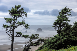
I made my way through Seaside and kept going south. I finished at Canon Beach. This is where I will spend the night. Before turning in, I wandered around town, in the dark, by use of headlamp. I took some amazing pictures of the beach and Haystack Rock, lit up by the natural moonlight. The legend is that giant rock helps lead to the Rich Stuff.
Unfortunately I can’t stay in Cannon Beach. But the officer was kind enough to tell me exactly where to go, a few minutes down the road. Wonderful place. Wonderful police officers.

Day 39:
9950 miles and counting. Today I turned over the 10,000 mile of this road trip!
Last night I got rousted out of town by the police where I tried to sleep 🙂
I misread the sign and thought I could stay overnight. The officer informed me otherwise. We had a wonderful conversation and a few laughs, and I moved on down the road a few miles. I woke up near Cannon Beach Oregon. I stayed up late last night photographing Haystack rock and the waves lit up by the natural moonlight. It was a ton of fun.
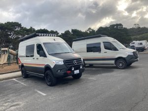
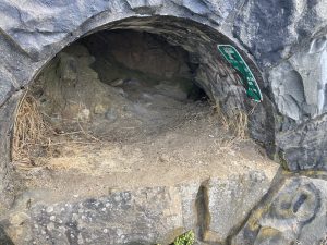
I stuck around where I woke up for a little while, wandering around and talking to some new friends. A lot of people just like me, wandering aimlessly, were all gathered together at this rest area on the coast of Oregon. Who would have imagined? So I took the time to chat with every one that would chat with me. It was all of them. I even parked right next to another BEAST! Once I started heading south on the PCH it wasn’t long before I was at the Tunnel of Fun. This geocache deserves it’s own entire entry, and I am sure someone has already done it. Duck Duck Go there if you want. That tunnel was so much fun I did it three times. Once because I had to, the second time because it needed a replacement log, and the third time so I could do it with a friend of mine on FaceTime. I would have done it 7 or 8 times if more of my knucklehead friends answered. People back east are not happy about how much fun I’m having.

View from inside the Tunnel of Fun

After a bunch of random pull offs and photographs it was time to head inland a little bit and find out about Hembres Ridge.
Today is the day I hope to finish up the continental portion of the cache across America series. Once I find Oregon, I should have 49 of the 50. Hawaii being my last. I guess I just hop on a plane right after?
I continue driving south on the PCH, stopping often, taking pictures, making new friends, and thanking the universe for my life. I finally made it to the parking area for Cache Across America, Oregon version. it wasn’t dark, but I was running out of daylight. I dashed up the hill, made the find, took my pictures, gave myself a high five down low, and went back to my van. just then another guy named Derek, with the exact same van I have pulled in. We talked for a long time, laughed and made fun of other people neither of us knew, swapped road trip stories, and I listen to him about how he pilots his own propeller glider? The video was insane! Derek also let me play with his dog.
I decided that’s where I would sleep for the night, so did Derek. I bed down for the night and reflected on one of the most amazing days of my life driving south on the Pacific Coast Highway.

I did start an album of this trip that I am updating as I process. HERE.
THE Hike I planned this trip around!

Day 36:
9600 miles and counting.
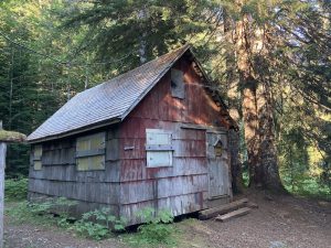
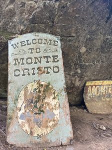
Today I met Zap, hands-down the coolest dog of my trip. Today was also THE day I was looking forward to when I left home for this roadtrip. This hike to Monte Cristo in Washington PNW. It is about 8 miles out to an abandoned gold mining ghost town. I KNOW! That is so many amazing adjectives! This was before I had any idea of the insane and amazing things I would accidentally get myself into.
This morning I woke up at Monte Cristo trailhead. I got started just before sunrise with my headlamp. I wanted to be on the trail and see the light as it rose, and hope for that Pacific Northwest beauty and glory.
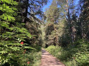
I can always tell when I’m the first person through a trail each morning. I’m the one that gets the pleasure of eating all the fresh cobwebs. I walked and looked for all the geocaches on the way out. A few had to wait for the return trip, I knew the sun would be up by the time I walked back. The walk was great. It was an old railroad, lots of it along a river. All of it through the giant trees and forest.
I made it out to Monte Cristo, put my name on the geocaching log, and was on my way back to the van just before 9 AM. The sun was finally coming up over the trees, it was exactly what I wanted.
The Monte Cristo hike in Washington state is the thing I looked forward to most when I left home over a month ago. Of course, I did not realize I would be on a JetSki in slot canyons.
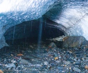
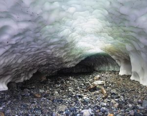
I got back to my van, made breakfast and then head back down the mountain a bit to visit the ice caves. I had no idea this existed until late last night, when local Mr. Ford, told me about this trail. I am glad I went. That was an amazing experience! I went uncomfortably deep into an ice cave, even for MY idiotic standards.
I met a family today who did the ice cave hike for their sons sixth birthday. I’m pretty sure for my six birthday I got a beating.
Try as hard as I might I was unable to find a way to penetrate, and get to the traditional geocache up here at the ice caves. I’ll have to settle for the two earth caches, but nothing feels like accomplishment the same way as writing my fake name on litter in the forest.
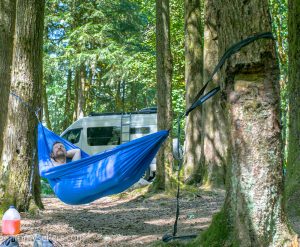
After I left the ice caves and the picnic area, I started to head back towards civilization but before I did, I found a beautiful spot along the river. I slung up my hammock, put on some mellow tunes, and took a few hour nap in the shade, along the river. That is not like me. It took me quite a while to wind down and allow my brain to except the fact that for the next couple of hours, I was not going to accomplish anything. Very tough for me.
After a nice nap, pack up minicamp, and head into Bellingham for at least 1 night.

Day 37:
I woke up in a hotel in Bellingham. The repair I had scheduled on my van window is not going to happen. So, I have hung around north eastern Washington for an extra week, with no payoff. Well, I did have the payoff of an amazing week outside and having fun! I saw a rain forest, I slept on the beach, I hiked to Monte Cristo, and on and on and on.
But today will be a dead day. I will spend the day catching up on real life stuff, while I have a hotel room and internet access. Hopefully catch up on my photo processing, and diary entries.
About mid day I finally went out to tour Bellingham, and complete my geocaching duties. I stopped by the webcam, a few virtuals, and a couple of whereigos and letterboxes. It was just a quick trip around town for a couple hours. After that, back to the hotel to keep working. Tomorrow I am back on the open roads, I think my destination will be Astoria. I am feeling a little Goonie, so it seems appropriate.

I did start an album of this trip that I am updating as I process. HERE.
If the options include rainforest, always choose rainforest

Day 34:
Today I met Bluto, hands-down the coolest dog of my trip.
9100 miles and counting.

I woke up in HOH Rainforest, Olympic national Park. I was not supposed to be here, and had no idea it existed. Now I am waking up here.
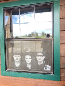
I stayed up late into the night taking pictures out along the river where the earthcache had me walk. Because of that, I slept in a little bit. I woke up to a hustling and bustling national park parking lot and skedaddled. I made it to Forks which is where I officially started my day with a couple of finds, learning some information about the town, taking pictures of vampires for my wife, and having breakfast.
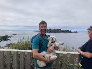
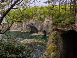
From there I decided since I was close, I’d head out the Cape Flattery. That wasn’t originally on my agenda, or even on my radar in anyway. But it looks like the top left corner of our country, so I thought I better visit. It was a fun drive out, and indescribably beautiful. I failed at almost every geocache I looked for. I made time for the earthcache and the virtuals as well.
Once I walked out to Cape Flattery, I realized that is where I need to be tonight, overnight for the sunset and photographing the night sky. Once again, the galactic band is going to be right over top of an amazing foreground. Cloudy right now, hopefully that clears up. It did not clear up that evening. So I just slept instead of partying all night.

Day 35:
9250 miles and counting.
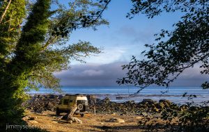
This morning I woke up in the Makah Reservation, at Neah Bay. The top left-hand corner of our continental country. I stayed out here overnight hoping to get some pictures, but the sky was overcast and cloudy all night. So that did not work out. Today I’m heading back towards Seattle area. On the way there I saw a van like mine parked on the rock and sandy beach. So, I stopped and chatted with that family for half hour. Turns out they are from DC, right by me, out here living life in a rental Beast. Took some great pictures of a Beached Beast.
I decided to take the ferry, even though they said it was a two hour wait. Because in life when you have a chance to take a ferry, always ride the fairy. I got to the ferry port and had a couple hours to kill. I walked around town, took in the sights of Kingston, and did the things I normally do in a strange town. Now I have another new best friend.
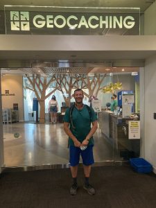
I put my van on a boat and road across the water. That was neat. I used that time to brush my teeth and get cleaned up a little. As soon as I got out on the other side in Edmonds, I head straight for Seattle proper. First, I had to go back to a giant needle and wrap my mouth around a bolt. After that it was time to head towards the Fremont area, I had a 4:30 PM visit at the Geocaching Headquarters. It is always brought up as a big time deal. I figured I better check it out. I would regret it if I did not. It’ll be dull, but I’ll have the memory and picture. I got there with about 2 1/2 hours to walk around and find all those world ranked favorited hides. Justifiably so, some really fun stuff for being in the heart of the city. After that it was time to go in and head up to the 3rd floor. I can honestly say I was visiting headquarters, because I think that’s what I was supposed to do. Without being disrespectful I hope, it wasn’t really the kind of thing I thought I would enjoy. I’m not big on history, memorabilia, tradition, any of that kind of stuff. I learned years ago that traditions are just peer pressure from dead people. But of course, I did what I was supposed to do. Boy, am I glad I did. I had a really nice time. I felt a real connection to something that I have a passion for my life, and lots of other people do as well.
After that I visited in the library, and then I skedaddled out of the city. Tomorrow I plan on doing the hike to Monte Cristo and hope to be at the trail head tonight before sundown and find a place to sleep.
I parked myself for the night at the picnic grounds just down the mountain from my big hike tomorrow!

I did start an album of this trip that I am updating as I process. HERE.
I made this video of the Milky Way:

Today was Nirvana

Amazing Sign!

Day 33:
8900 miles and counting.
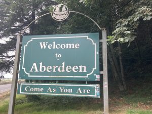
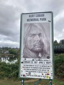
I slept in Elam Washington, and got my start this morning by heading to Aberdeen. I spent quite a while walking around town and taking in the history. I am the perfect age for Aberdeen Washington to mean way more to me than it actually should.
I also visited a giant graveyard on a hill. Of course. You can always count on me, visiting graveyards. If I am not finding a geocache there, I am stealing water. Probably both, and a third thing, that you know what.
After that I head straight to the coast. My intentions were to find the cache across America, Washington state version. Then from there I wanted to get all the way to the north and west while going through Forks. My wife made me promise that if I did this trip, I would make it to Forks. She apparently thinks that I can bring back the ability for her to be a vampire? Not sure what that means, but it means something to her.
Currently I am having to kill a weeks worth of time around Seattle. I have a window repair on my van scheduled in Bellingham next week. So, I can’t get too far away, or I’ll just have to backtrack. I’m hoping to make it all the way to the top left of Washington. Spend some time in Olympic national Park. And at some point, I still must make it east of Seattle to Monte Cristo. That is the hike I was looking forward to most, when I left home with a loose itinerary.
I drove the full loop around the lake in South Olympic National Park. I drove out on the South Shore and then back on the North Shore. I stopped for pictures a few times, including about an hour of climbing up and down rocks taking pictures of a waterfall at the geocache. I guess that’s not inside the park if there is a physical container? I stopped for a couple virtuals as well.
Once I left on the South Shore road I was finally attempting to get to Forks.
I never did make it to Forks today. I was driving along the 101 and saw a sign that said HOH Rainforest: make a right. I couldn’t turn down the offer to see a rain forest. I didn’t know anything about it. I called a buddy back home who is a big nerd. He said that if I have the opportunity to go, I needed to go. So, I made my way down that road, through the entrance gate, and I went into HOH rainforest. I didn’t see but maybe 10 other people the whole time.
I got into the rainforest, I parked and did some hiking. Very little of the rainforest is actually traversable, which I am sure is a good thing. Reminded me of the Galapagos Islands… you are really only allowed to see about a millionth of a percent. I did the two loops by the campground and checked out both of those earth caches. I’m so excited about the spot where the rainforest meets the lake. I plan to go back there in the middle of the night to photograph the sky. It faces the perfect direction south southwest. Fingers crossed for great results there. After the hikes just enough time for a shower and a quick bite before hopefully I’m heading back into the pitch-black woods.
I hiked back to the forest/river intersection about 10pm and spent 3 hours there taking pictures. I watched the stars, listened to music, and maintained an overall gratitude for this unbelievable life I get to live. What a day. Cool towns, rainforest experience, watch the milky way dance. That sounds like a well balanced diet.

I did start an album of this trip that I am updating as I process. HERE.
Very eventful Idaho, into a calming Washington

Day 29:
8000 miles and counting.
I drove yesterday until I ran out of daylight. I stole an extra hour somewhere in Idaho, but that doesn’t change when the sun goes down in relation to when I started my day. So, I found a nice place to park and sleep along the river, during the homestretch of my drive to GC26 and 27, 2 very old geocaches in Idaho. I woke up nice and early, started moving immediately. In hindsite, glad I did. I thought I had 3 things to do. I never imagined those 3 things would take the entire day. The plan was for the three old ones in northern Idaho, and then on to Spokane where I’ll settle down for a day or two, and stay still.
Well, I had an eventful morning. By 8am I had found two caches from the year 2000, and busted out a side window in Perrvie, my van. Thankfully, it’s a small window, but that doesn’t change the fact that it sucks. All I can do now is keep driving north up to the camel toe stash.
It’s really great that the Camel Toe Hide has all those helpful coordinates for where to turn! I was able to use them the SECOND time I took a run at getting up there. At first, I went up a path all the way to the summit and started coming back down. I stopped and looked at my Gaia map and noticed I wasn’t going to be able to get there from here. So, I had to backtrack the last 30 or 40 minutes of driving, 5 miles. Now I follow the directions, and wouldn’t you know? that was a piece of cake. I decided to walk the last mile uphill. I think Pervvie could’ve made it, but I already lost one window today. Plus, I haven’t been doing a lot of walking, so it’s good to move my fat ass.
I found a handful of geocaches in that area, took a bunch of pictures, and it was time to get out of there. I’m getting a hotel tonight at Spokane, maybe even for tomorrow. I have to look into what to do about this broken window. And maybe just stay still for a minute. I can’t believe tomorrow will be 30 days. Yikes.

Day 30:
8400 miles and counting
I stayed in a Holiday Inn Express last night. I think this means I am now certified to do heart surgery? I think I would be great at it, nobody will give me a chance, unfortunately.
I then spent the entire day in the lobby catching up on work and pictures stuff. This is the first day in a month that I have ‘taken time off’. I have been nonstop for 30 days. It is insanely hard to get me to stop, slow down, or do anything not on my agenda. Glad I followed through. I got much more caught up on stuff that I have been neglecting.
I spent until mid-day working at the hotel in Spokane. I was catching up on photography stuff, and real work stuff. Then I finally got on the road. great idea to get on the road around a city at rush-hour.
I continued to head west, but with no real destination or agenda. That’s the first time in a while. I made my way to Potholes State Park. I struggled with the birdhouse there for a while. So long in fact the sun went away. So, I decided to just go ahead and sleep in that state park. I had dinner and did a nearby multicache from the comfort of my mobile bed. Quite a day. I found a lot geocaches along the way, and took a lot of pictures.

Day 31:
8500 miles and counting.
I woke up at Pothole State Park medium early. Earlier would always be better, that’s a general rule.
I solved a multicache while laying in bed last night, and went for that final. After that I continued further west. Just like every day before today, my plans have changed 10 different times. Now I need to stick around the Pacific Northwest for the next week, as I have a repair scheduled on Pervvie’s window in Bellingham next Thursday. So right now, I think I’m gonna go ahead make it all the way to the coastline and then work my way back inland towards Seattle over the next few days.
I keep seeing a lot of people I know in real life on these logs I’ve been visiting lately. I guess that’s what happens, people plan a road trip that involves Geocaching, and we all have about the same type of idea. I know for me it has nothing to do with numbers. Those just seem to be happening organically. I guess there’s something happening in Seattle in the near future that some people I know we’re heading to.
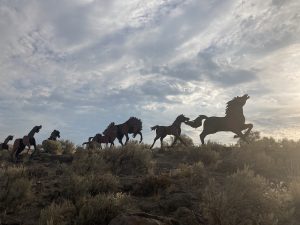
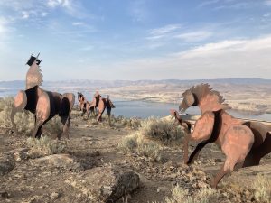
My first stop of the morning was out at the wild pony’s art piece. I love stuff like that. I’m not a big art lover, but I am a big fan of when people do weird things. And giant metal horses on the top of the hill is definitely a weird thing. I also think that’s the same artist from a virtual I did in Spokane the other day. David Coverdale. Isn’t he in Whitesnake?
Now I think I’m gonna head on to Snoqualmie Pass. I’ve been here before, several times actually. This time I’m gonna take the time to find all those important geocaches nearby.
I got a lot done at Snoqualmie pass today. So did a lot of other people. Holy cow it was like a train trail of geocachers that entire stretch of trail here. I have seen 5 or 600 other Geocachers. Now I found out why everyone is flocking to Seattle. A big event there at the headquarters. I toiled with trying to go. It seems like I must. I have traveled almost 9k miles, in 30+ days, geocaching my way across the country, and it culminates in a big deal event? I think I would be smacking the Karmic Universe in the face if I did not go. Crowds are not my thing. Neither are cities, parking, and everything that goes along with those.
Anyway, I was able to find everything I looked for. I put in 10 miles on a bike and almost as many by foot walking as well.
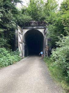
That tunnel at Snoqualmie Pass is a surreal experience, unlike anything else I’ve experienced. I am so grateful and thankful to have been able to experience that. Quite a productive day!

I did start an album of this trip that I am updating as a process. HERE.
Getting out of Vegas, and back to the wild

Day 25:
6400 miles and counting. Woohoo! Today is the day I get to scram out of Las Vegas. My pretty girl is all fixed up, and ready to get back on the road. She just needed a rest, like every beautiful lady, she needed time at the spa. After a fresh bath a bunch of new bolts, some new sway bars, and a whole lot of TLC, Pervvie is back on the road and ready for adventure. It felt so good getting into her after a few days absence.
On the way out of town I did a few miscellaneous Geocaching things, and a trip to the food market to get restocked up. I was hoping to steal some water from somewhere too, but I have plenty for now. I am heading directly north, into the desert. I plan to drive for a couple of oldest hides in Nevada, and some other highly favorited geocaches along the way. I believe my next destination is going to be rattling around Idaho. But so far, my plans only work out 50% of the time. The other 50% of the time I end up doing something way better than I ever planned or imagined.

I drove all over, all through, and all around all of these power trails out here in the middle of nowhere. I stopped for more than I thought I would. But still very little. Just the high favorite ones, and the older ones. If I had the willingness, I could’ve had a find count of 20,000 higher than I do now. But that just doesn’t seem like having a fun. The fun for me is just driving around in the desert, getting lost in my own thoughts…not pretending I’m a mailman.
I found all the main ones that I wanted, and some others. Basically, where I stopped to pee, take pictures, sometimes both of those things.
Time to head north for the oldest one. I was in a big conundrum. The van said it has 90 miles left of fuel. I was 30 miles one way from the main road, and 30 miles from the town of Tonopah. I had to drive all the way from Golden Arrow, to Tonopah, turn around come all the way back, go to the old one north, turn around and back through Tonopah. Poor fuel planning.
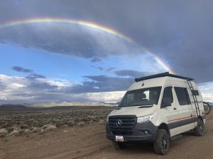
As I turned left off of the main road to go north on a dirt road, I noticed “I want to kill you” weather, in the distance. Behind me was the most beautiful bluebird skies you could ever imagine. However directly in front of me was the most terrifying, menacing sky I’ve seen yet on this trip. Oh well, that’s the way I must go.
Thank you so much for bringing me to the location of Nevada’s oldest geocache. I was treated to a spectacular show of storms and skies and clouds and then ultimately rainbows. That’s right rainbows with an ‘S’ at the end.
From there I made my way to Ely, found a nice place to rest for the night. Tomorrow is hopefully north to Idaho.

Day 26:
I woke up in Ely, Nevada at a Love’s. 6900 miles and counting.
I am planning to head into Idaho. I got moving this morning not quite as early as I would’ve hoped, but after a few nights absence, I was extra cozy in my mobile home’s bed.
I changed my plans for the 10th time today and a millionth time this trip. I made a detour back through Salt Lake City. I couldn’t spend much time there, because it was during a time when I thought I needed van repairs and was anxious to get that done. I drove and wandered around an empty Salt Lake City on a Sunday. The weather was beautiful, and it was a perfect time to be Geocaching as there was no one else around to see me acting weird.
Having grown up on the East Coast, I will never understand how I am able to drive 3 hours or more, at 80 miles an hour, and not see another human being. Did they build these roads just for me to use?
From there I was going to head to the Golden Spike. It occurred to me I had a few errands, and I was in a major suburban area. So, I stopped off at the Home Depot, the Office Depot, the Auto Depot, and luckily picked a town with some really highly favorited caches and a WebCam. This detour was a lot longer than I had planned on.
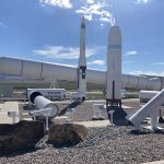
After visiting a choo-choo train history spot, I backtracked to the missile exhibit. That was so much more fascinating than I ever expected. I went there for the old virtual and the letter box. I spent about 40 minutes on that letterbox. First, I couldn’t find a sign. So, I did some alternate research and narrowed it down to a couple of options. But then I was messing up on first letter second letter third letter first words 2nd word third word. There was a nice big hint in the combo description by the owner. And I still thought I knew what I was doing. I got about 10 minutes away driving, and it clicked. Turned around went back, got my name on that letterbox too.
So glad something routed me to that spot. I never would’ve made it here on my own.
Now it’s time to finally try and get in Idaho.
I made it to southeastern Idaho before I ran out of day. I was able to find the old one in Southeastern Idaho, but not without issues. For some reason I had notes that said I could drive pretty close to this one. I guess 2 miles round-trip walking is close, but it was probably also a half of a mile uphill. I was running out of daylight. Poor time management, so I had to jog the whole time up the hill and then back down to where I left my van. After that I was officially out of daylight. I found a nearby spot to park and sleep for the night.

Day 27:
7500 miles and counting.
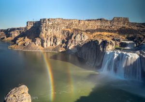
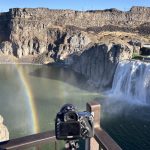
I woke up in Idaho and made my way to the waterfall earthcache. I spent much more time at the waterfall area than I ever imagined. I did a couple of short hikes, and found a bunch of geocaches. I took some pictures and I chatted with some other nice travelers. I met some motorcycle enthusiasts from Australia. They told me they drove their bikes all the way to Idaho. What I thought would be a quick in and out ending up being several hours of my morning. Thank you for that.
After a few miles of jogging and climbing around all these awesome rocks, the park filled up. People were swimming in a little lake/pond/pool area. I was hot and sweaty, and that look like an awesome thing to do. So, I did it. After a refreshing dip in the lake, I went and utilized my indoor shower. It’s a real special occasion when I use that thing.
On the way out of town I had a final of the Wherigo. I realized how I had to get there and said, damn, I just took a shower. So, I walk extra slow and tried to stay nice and zestfully clean.
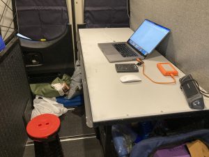
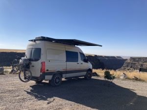
My second stop for the day was out at Bruneau Canyon. Even thought it was early in the day, I knew it was where I wanted to stay the night. The possibility of amazing night skies were high at this location. If they skies stayed clear. I have my sights set on the Cache Across America Utah version, and I believe there is also a virtual there. I had a couple hour drive. I had hoped to get there, long before sunset, and set up camp. Everything worked out perfectly. I had hours to kill before photographing the sunset and night sky. There was telephone service, and I was shocked. I was able to use that and catch up on work. I put Pervvie into Work MODE!

Day 28:
7700 miles and counting.
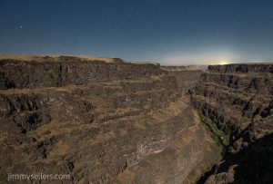
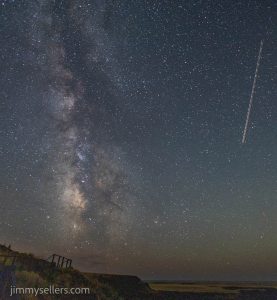
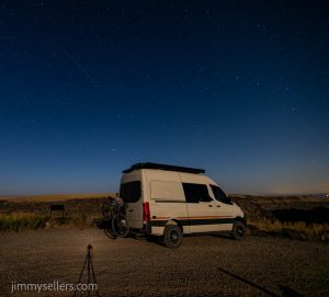
Last night I simply stayed where I landed around mid-day, at Bruneau Canyon. I had the entire place to myself from about 4PM on. I had some telephone service, so I spent a few hours catching up on real life work. I was basically just killing time waiting for the sun to scram. The skies were perfectly clear, and I was treated to a spectacular show of the moonlight rising and lighting up the canyon inch by inch. I got some great photographs of the Milky Way before the moon entered the show. And then some super fun shots of the canyon illuminated only by moonlight.
Now it’s time for me to head towards Boise, and then ultimately all the way north in Idaho. I have a few checklist items on my agenda, but I’m also open to getting into anything fun.
As I was driving away from the canyon on my way to Boise, I noticed a couple of power trails. Yikes, I don’t have time for that. But I noticed there was a whole bunch that were challenges. I made time for some of the more interesting ones that I knew I should qualify for.
I made it into Boise to check off a few specific tasks. While I was there a few other things distracted me. I also refueled Pervvie, and restocked the refrigerator. Yes, that does include a box of Cinnabon‘s. I wasn’t there long, but I knew I had plenty of city already. It was time to start heading north and get back away from people and things. My destination was GC 26 and 27. Two very old geocaches, as evidenced by their GC codes. It would be nightfall before I got there. So, my hope is to get all the way there, and have that be what I do first thing in the morning. An absolutely gorgeous drive to start out with. Meandering, twisting back-and-forth following the river that was rushing at me. I didn’t get all the way there, so I found a nice place to park and sleep along the river, during the homestretch of my drive to GC26 and 27.

I did start an album of this trip that I am updating as I process. HERE.