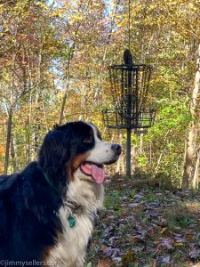
A few more days in my (current) new typical life

Day 15:

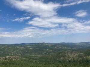
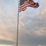
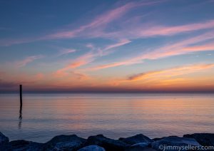
I was driving early before the sun, and it did not disappoint. The skies were beautiful as the sun came up over the South Dakota farmlands. Shades of pinks, blues and oranges that I rarely get to see.

I made my way toward Hot Springs with the expectation of finding out what that town was all about. I arrived in Hot Springs about an hour and a half before it opened. So, I spent that time cruising around the town, finding some geocaches and visiting some graveyards. Then I kept heading north and spent a little time in Custer. I found a couple of really fun geocaches in that town, and stocked up on food for both myself and Perrvie. Next stop, heading further north toward Campcache, the oldest geocache in South Dakota.
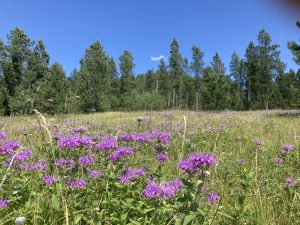
I spent the entire day and found the two oldest geocaches in South Dakota. I knew I was going to look for one, but didn’t realize the other one until I was nearby. Talk about an adventure that almost didn’t happen.

Holy cow. I think this has springboarded forward it to the greatest Geocaching adventure I have ever had, on all accounts.
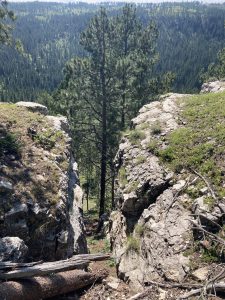
I finally got to do some of the off-roading I’ve been wanting to do. Forest roads of South Dakota are treacherous, terrifying and unbelievably fun. After about a two-hour delay by going the wrong way and only traversing about 10 total miles, I finally ended up at the proper location to look for this geocache.

I was kept navigated, safe and alive by my great rock climbing shoes, a new application, Gaia, I put on my telephone, and my amazing adventure van, Perrvie.

At first, I followed the GPS to a Boy Scout camp that was kind of close, but not as close as I could get in Perrvie. So, thanks to the brand new off-road GPS app, I was able to figure it out and route myself, rather than trusting the Apple Overlords.

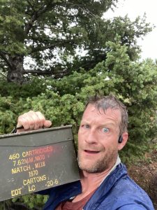
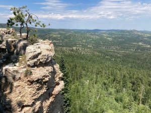
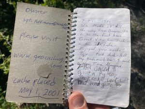
Rewind, and erase the last hour of driving to get back to where I started, and go the other way. Then I drive about 4 miles in 30 to 40 minutes and arrive at parking. Thankfully parking is within about 300 feet. The last 100 feet is a doozy and straight down through rock crevices. I made my way down no problem I spent about 15 to 20 minutes searching and finally found the ammunition can in question! I sign in, take the obligatory pictures, and realize I must get myself out of here. That was no small feat, but a week’s worth of rock climbing for babies training, and these amazing shoes, and I was up and out of there lickety-split.
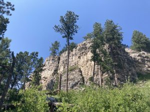
I can’t believe how lucky I am to have had that adventure, it is one I will never forget.


Campcache:

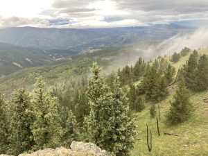
I love that this old one had parking coordinates listed. I was easily able to navigate there and realized I was only 3/10ths of a mile away. Maybe this wouldn’t take as long as I thought. Or maybe it will take as long as I thought. I just walked in a straight line from where I parked to Ground Zero. If there was a trail up, I never saw it. That last 500 feet was 500 feet that I’m not used to traversing in such a short distance. But I made it up, then realized I had to go all the way up. I thought I saw a nice way up on the right hand side, but am all the way to the left. I checked there before backtracking and ended up wall walking up one of the crevices. It was the perfect width for me to spider man up. I would be able to that easier way down on the other side. Once It was time to go down, I didn’t find that easier way down I thought I saw. So I went back the way I knew I could, and went down like a reverse-spiderman.
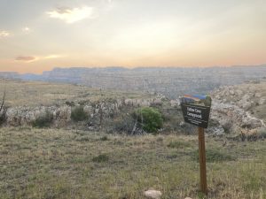
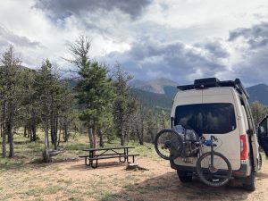
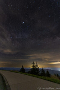
From here I wanted to get to the Outlaw Campround in Kaycee Wyoming before sundown. I wanted to camp and take pictures of the night sky there. I visited there last time I was through this area, and regret not spending the night. Now I am in this monster adventure van that can get me to these spots, no problem! I made it there at dusk, and stayed up until the sunrise, taking pictures of the night sky, and the sunrise. Now that I have gone through those pictures, I have some of the best I have made yet.
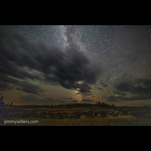
All total, this could be the greatest uninterrupted, 24 hour period of my life.


Day 16:

Today I started late, only getting a few hours sleep, from sunrise until about 9. Once I woke, I had to pack up my camp and van, break down all my camera equipment, get cleaned up, and get on the road further west.

BUT before I did, I was going to avenge this nearby DNF from last time I was though here. The Hole in the Wall I could not get to. With this amazing 4wd adventure van, nothing was off limits. Boy was I wrong. I got a lot further than I did last time in my 4wd Tahoe, but I had to turn around when I was about 1.5 miles away. In the moment I panicked and was very anxious. I did not want to break my amazing baby, Pervvie. In hindsight I know I should have walked the last 2 miles. It was about 100 degrees, but I could have done 3 miles without issue. I just did not think of it then, I had self, and Pervvie preservation in mind. So alas, strike 2 at this same geocache in Wyoming. I have about 6 hours of my life invested. Maybe one day.
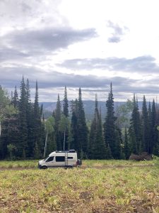
After that it was time to get to the western edge of Wyoming. A not at all quick side trip to Capser to visit a truck wash, and hopefully I will be on my way soon.

Well, I ended up driving away from there. No bath for Pervvie, my home on wheels today.

I drove almost the entire width of Wyoming today. I have no idea how it could feel like I was the only person on earth. Boy, I really love it out here.

I learned a lot about all kinds of different trails. The Postal Pony Trail, The Book of Mormon Trail, the Pioneer Trail, and of course the Oregon Trail Trail. Lots of people used this area for travel cross country. Yeah, duh, I am doing it right now. Of course this is the path they took. It is blacktop all the way. I took pictures of an amazing sunset along the way. I found a few geocaches as well. I stopped about an hour from my next destination, Bridger-Teton. I had hoped because of the title it was closer to the Tetons than it is, never too much of a good thing.


Day 17:

I woke up about an hour drive from Bridger-Teton, the old geocache. First I went over to Big Springs. I came all this way for the old geocache nearby, why not make my way here. Boy, am I glad I did. The find itself was a little difficult. I ended up being glad I had some off-line logs saved, read those, and then bear down to make the find. I also spent at least an hour here between showers taking pictures of the waterfall and spring. It was the perfect time to be here, overcast skies, a light rain, the wildflowers colors were popping. So glad I decided to make this little sidetrack. Thanks for bringing me to this awesome place!

After that, I had to backtrack around a mountain, and go find Bridger-Teton. I slept near a lake about an hour away from here. As soon as I got on the road, the paved road ended. That was fine with me and Perrvie, I came equipped with an adventure van, I can handle anything, I hope. On our way to the Hams Fork campground, I decided to go to Springs first. After that we doubled back to the campground near our way to this old one.

I parked within a 400-foot uphill walk. Probably not the greatest idea I’ve ever had, possibly even the worst. But I made it there, getting out might be another story. Spoiler, I made it.

I found the ammunition can I was looking for, and saw that someone had already signed in before me today. I wonder if our paths crossed anywhere.

All total I spent about four hours, found two geocaches, and traveled about maybe 6 miles. Those are some good statistics.

After leaving Wyoming for good, and Bridger national Forest, I made my way to Utah. I have an agenda there of some old ones, the cache across America, and a few others that might get in my way. I hope to also spend some time in the Moab area.
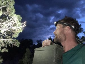
I made it to Clover Spring Campground early enough in the day. I’d bebopped around that whole area for several hours, finding some others and some challenge caches and a multi. I had a blast. Now it’s time to head off to Pony Boy.
The sun was starting to set as I got moving on the Pony Road. So many caches. It almost hurts to look at the map. I know what I am here for. I find the Pony Stash under light of a half moon, and a headlamp. Another 2000 found! I signed in on a few of the others that I stopped at for various reasons. Obviously, I went to the pet cemetery, and I also chose there to spend the night. Kinda cool, I know.

Sometimes I simply don’t understand this life I get to live.
2 Time Lapse Videos I made of the Night Sky in Wyoming

This is night turning into day

This is another angle, different time of night


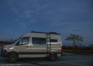
When I bought this van I am lucky enough to have, I had 1 place in mind. That place is the Outlaw Campground near Kaycee Wyoming. I was lucky enough to visit there before, but nothing more. I knew it is someplace I would love to stay the night. It also has some of the darkest skies in our country. Not only was I lucky enough to visit again, but this time I spent time, and an overnight there. I ran 2 cameras all night, taking pictures. I did everything I dreamed. Sunset, night, sunrise, pics from the roof of the van, off-road 4WD, everything I imagined. So grateful.

Here comes the next hunk of time for my August 2022 travels

Day 11

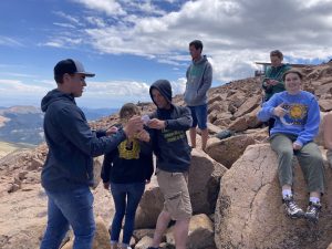
After 2 long and successful days of travel, hiking, climbing, and geocaching, it was time to get a hotel for the night. The night skies are not cooperating. There was no reason to stay the night in the middle of nowhere Colorado, when the skies are going to be cloudy and not clear for the New Moon. We stayed the night in Colorado Springs. We had an amazing Thai dinner and then a leisurely morning. The next thing we had to do was be in Estes Park by nighttime for a rafting trip tomorrow. We made our way north through Colorado, stopping by Pikes Peak on the way. We were able to drive all the way up, spend a ton of time at the top, and enjoy watching the weather change and scare everyone about 3 times in an hour. One of my most memorable finds ever is going to be at the peak of Pikes. It was a traditional in the rocks, just off the walking path. Wifey and I spent about 20 minutes with no luck. It had just been found earlier in the day too! After some time, I think I was ready to give up. Next thing I know, a lady asks if she was in our way. I told her no, we were looking for a geocache. She got very excited, yelled for her kids to hurry up and get back here, and the next thing I know, about a dozen strangers are looking for this geocache. Most knew about geocaching, others were friends of theirs just aimlessly looking in rocks. It was truly hysterical, and an amazing reminder of how much fun it is being a human and interacting with strangers. That is a skill that has not been exercised as regularly lately…for some reason. It still took a long time, I bet we were there for an hour, finally a young man yelled, “I found a geocache!” High fives were given all around, and a bunch of pictures.

On the drive down we stopped at the halfway picnic area and had leftover Thai dinner for Thai lunch. Thanks to our campervan for keeping lunch refrigerated until needed. And thanks to Colorado for the most spectacular picnic spot in the world!

From Pike’s we made the drive to Estes Park, where we will bed down for the next few nights. What a great drive. The skies were amazing, ever changing, and so dramatic. Saw lightning bolts in one direction, and perfect blue skies in the other. I love this world and this lucky life I get to live.
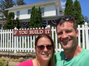
During that drive we also stopped at Buffalo Bill’s alleged grave, and a few other interesting places that presented themselves.


Day 12

Today was all about rafting. Nothing geocaching to report at all. We booked a half day rafting with an outfit I have used in the past. This time we did a very mild section of the Cache La Poudre River. OK, I guess I did do something Cache related today. Forget everything I said before this.

We had a blast. The weather was perfect. The water could have been a lot higher, but it is that time of year, running out of snow. Nobody went overboard, there were not water fights. It was far from boring, but there was also not nautically themed drama, like I am accustomed.

We had a great dinner at the Owls, and I found a geocache near there.


Day 13

Today was the final of 3 Via Ferratas during this road trip. This was on private land near Estes Park. It was on some fantastic looking youth camp. The kind of thing I can only have dreamt to participate in, as an awful child. It was by far the most challenging. Much more rock climbing than traversing. Wifey did great on it, and all 3. I am so proud of her. After that I drove out for a letterbox I attempt in the dark last night and failed. Easy peasy today when the sun is shining. Someone in my group wanted to nap, so I cruised the town. I did 1 ½ adventure labs. I walked all over the lake areas. I went from end to end of this town for all the geo-related items. I do not think there is a more inefficient way then the route I made today. I had a great time. After all that, we finished with a fun meal at Dunravens, which is where I drove from to pick up my dinner date. Like I said, lots of rerouting and inefficient travel today.


Day 14

Probably not much of a reporting day. Today is the day that Wifey flies home on an airplane from Denver. After that I will head a bit further east, and then work my way all the way back west.

After the Denver airport drop off, which went smooth but very sad, it was time to continue and see what I can get into on my own. I started by going a bit out of my way back east, to grab the Kansas oldest geocache. I found a few others in between, but mainly focused on getting from place to place. I have a packed agenda of things I want to do. And I don’t know how long this fairytale is actually going to last. (I still don’t)

After the old one, it was time to head north to Western South Dakota for that old one.

My first day driving alone it was through the sweltering heat of Eastern Colorado. I appreciate all the kind folks and farmers that afford me the privilege to eat whenever I feel like it.

I made sure to stop by Carhenge, since it was directly in my route. What a wild place that is. I think my favorite thing about people, is just how crazy they can be.

I learned a lot about all kinds of different trails. The Postal Pony Trail, The Book of Mormon Trail, the Pioneer Trail, and of course the Oregon Trail Trail. Lots of people used this area for travel cross country. Yeah, duh, I am doing it right now. Of course this is the path they took. It is blacktop all the way.

I continued north, eventually picking a town to sleep for a few hours, near the SD/KS border.

I intend to be out and moving tomorrow before the sun, so that I can watch it come up, in all it’s glory. WOW is tomorrow an unrealistic day!!

A few more diary entries for the Summer Carnival 2022

This is all very outdated by this point. It is also nothing more than a (mostly) copy and paste of my Geocaching logs. But who cares.

Day 6
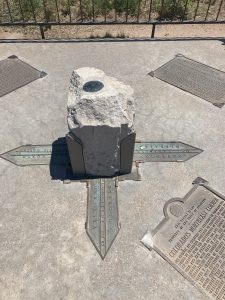
Today was an all-day drive from Cheyenne Wyoming to Telluride Colorado. It can be done in 7 hours. We were moving from 6am til 10pm. That is more than 7 hours. Lots of fun in between! Driving most of the length of Colorado was a blast. We stopped at a bunch of cool spots for pictures. We rode the lift to the top of Monarch Pass. We stopped for a few awesome geocaches, including the Cache Across America, and the oldest in Colorado, Terryall. Having an all-wheel drive adventure van kicks ass for this stuff.

Day 7
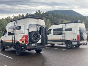
Today was our first of 3 via Ferratas on this trip through Colorado. Today we climbed around in Ouray. First time I have been to this town. So close to Telluride, yet still somehow so far away. What an amazing set up they have there. We started early, were done by lunch, and had lunch at the Ouray brewery, great burgers. After that we bopped around town for a while, did the adventure lab, ran into a guy with the same van as me, except way better, then finally head back to home base in Telluride.
The Ouray Via Ferrata would end up being the easiest of the 3 for me. It was still technical. But it was very much like a lot of rock scrambling and climbing I have done against everyones better judgement.

Day 8
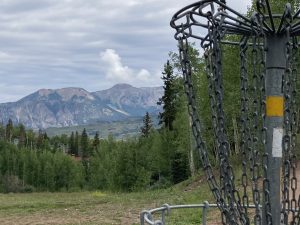
Today started wonderfully with a round of frisbees at the course in Telluride Mountain Village. It was only a few minutes walk from where we are laying our heads for a few evenings. Now that is a frisbee golf course of ups and downs like I have never experienced. I think the greatest part for me was also a bit surreal. I have spent more time on this Telluride mountain, snowboarding in the winter, than hours I have spent contemplating the meaning of life. 1 winter I spent 4 weeks here. I have always said that we needed to come back in the summer. Finally, it happened! Walking around on these slopes that I came zooming down countless times gave me such a smile.
After the fun round of frisbees, it was time to ride the gondola down to town for lunch. We ate at the BBQ spot right at the bottom. After that we strolled around town for a couple hours, enjoying the perfect weather before the storms would come and ruin everything. I found a few geocaches that I either neglected in winters past, or were new since my last visit.

Day 9
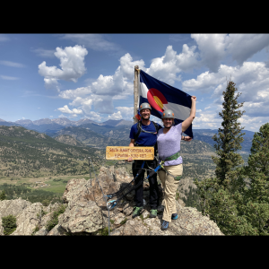
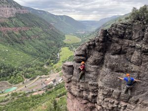
Today was the 2nd of 3 Via Ferratas we planned this trip. Telluride was today’s location to climb around on the mountain side. This is definitely my new favorite of the ones we have done. The views from the wall alongside Bridal Veil Falls were indescribable. The pictures of us on the mountain side look photoshopped. I could not believe that after we started the trek, that is when I decided to open the Geocaching application on my telephone. A cache only .3 from here? And the title is Via Ferrata? Oh boy, this could be my new favorite geocache of all times! We made it to the spot after the Main Attraction. I knew we would not search for too long. And we did not need to. Our guide, Coop, spotted a pile of rocks. I moved in for a closer look, and BAM! A geocaching log dating back to 2016, with only a handful of signatures on it. I explained to the guide that the Venn diagram of geocachers and people who do Via Ferratas is me, and these other 20 people that have found this particular geocache. The rains held off until the second we got to the parking lot. I could not have planned it better if I was asked.
We left Telluride with an entire day of driving planned. We were going to end up in the southeast of CO, somewhere near the old “geocache”. We drove through Ouray, Silverton, Durango, and kept going south-ish. We ended up sleeping at a sketch campground somewhere on the highway. I missed all the great pull-offs. This left us 2 hours from the old Geocache.

Day 10
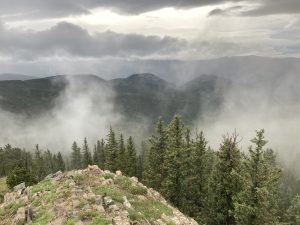
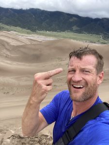
I started driving about 4:30am heading toward the old Geocache, we had about 2 hours to get there. Somehow yesterday we drove all afternoon, but did not make much ground. I arrived at the campground (which was my original planned ending point last night), just before sunrise. I put on my headlamp, but never actually needed it. I found the cache on the walk out, and then the 2000 one at the vista. The entire walk I was socked in by clouds. I could not see too far, but I knew that view would be amazing. I stood there for about 2 minutes, a giant wind came through, pushed everything away, and left me with a gorgeous, post sunrise view. I got a fantastic picture. I assume the lord had to fart, and farted in my general direction to move the clouds. Then a quick jog back to our CAMperVAN. Back on the road again, next destination, Great Sand Dunes NP. WOW! What an insane place. It makes zero sense to be in the middle of Colorado. We spent a few hours there. I made my way around the area, reading signs, and climbing on sand dunes. I wanted to make the trek out for the EC that was far away, and I did. It was tougher than I expected. I saw a recent DNF from someone I know from home. I assumed that meant that all the Dunes blew away? Or someone stole them? A DNF on an EC…now I get it. So worth the trek. The view from the top of the dunes is spectacular. I can’t believe how far they go on for. So glad we made time to visit here.
After GSDNP, we head north to CO Springs. There was no reason to stick around down there, the clouds and storms are going to be all night, and there will be no night sky to photograph. So, into COSP, for a few to-do’s and a hotel and shower for the night. First was the zoo, to get breathed on by a giraffe. Bad breath, honestly almost knocked me out. Then over to Pauls Stash for the 2000 geocache. Wow, the GSDNP EC, and Paul’s Stash on the same day. The time spent in that canyon near Paul’s was mesmerizing. I got rained on the entire time, mostly drizzle, lots of thunder. I got the 2000 Stash, 1 puzzle, a traditional and hopefully and EC during that grueling 1.5 uphill miles. I didn’t walk a lot of miles today, but I did walk a lot of elevation.
These past 2 days have been 2 of the best in my medium-lengthed life.

I found another Geocache

I find a lot of geocaches. Some really stand out. Most do not. This is one that has stood out from the almost 10k others.

I don’t usually like to talk or post about finding geocaches, because it happens all the tine, but I couldn’t help myself with this one. This was just too great of a life experience to not digitally document, forever.

I spent the entire day and found the two oldest geocaches in South Dakota. I knew I was going to look for one, but didn’t realize the other one until I was nearby. Talk about an adventure that almost didn’t happen. Holy cow. I think this has spring boarded forward to the greatest Geocaching adventure I have ever had, on all accounts.

Thanks to my unofficial, uninformed, unaware sponsors, Saliwa for the shoes, Storyteller for the Pervvie van, and Miracle Whip for fueling me.

I finally got to do some of the offroading I’ve been wanting to do. Forest roads of South Dakota are treacherous, terrifying and unbelievably fun. After about a two-hour delay by going the wrong way and really only traversing about 10 total miles, I finally ended up at the proper location to look for this geocache.

At first, I followed the GPS to a Boy Scout camp that was kind of close, but not as close as I could get in Perrvie. So, thanks to the brand new off-road GPS app, I was able to figure it out and route myself, rather than trusting the Apple Overlords.

Rewind, and erase the last hour of driving to get back to where I started, and go the other way. Then I drive about 3 miles in 40 minutes and arrive at “parking”. Thankfully “parking” is within about 300 feet. The last 100 feet is a doozy and straight down through rock crevices. I made my way down no problem I spent about 15 to 20 minutes searching and finally found the ammunition can in question! I sign in, take the obligatory pictures, and realize I have to get myself out of here. That was no small feat, but a week’s worth of rock climbing for babies training, these amazing shoes, and I was up and out of there lickety-split.

I can’t believe how lucky I am to have had that adventure, it is one I will never forget.

Summer Carnival 2022?

In the winter of 2012, I participated in the Winter Carnival 2012. I dropped everything, worked from the road, and followed the snow finding powder to snowboard in for 4 months. 10 years later I appear to be off on another unrealistic journey across the country.

I don’t know how or why, but I am lucky enough to be able to travel cross country, again. This will be the 4th time in a few years. This is another make-a-wish, dream come true situation. If you told 19 year old me I would be traveling freely cross country, in the most unrealistic adventure van imaginable, I would have said…..Yeah, makes sense.

On paper, this is set to be the greatest adventure yet. 2 weeks with Wifey, traveling, Cheyenne Rodeo, Colorado top to bottom to top, 3 via Ferratas, 1 rafting, and some stuff I am forgetting in a pear tree. After that, I am destination unknown with a loose itinerary and agenda. Very reminiscent of my Winter Carnival 2012. So lucky, so grateful.

This trip will not be about snowboarding. It is about seeing things I have not seen before, taking pictures, and doing to funnest things that Geocaching has to offer.

Here is how I describe it from the start:

I am currently on an undetermined length cross country road trip. My wife and I left Maryland in our Campervan, heading to Cheyenne Wyoming for the rodeo. From there we are heading into Colorado for a while to do some climbing, rafting, relaxing, and take photos. Once she heads home on an airplane from Denver, I will be wandering the country aimlessly, living in my camPERVan. My goals will be to finish the continental portions of the Cache Across America series. I have 5 of those left. I will be following a trail of really old and really fun geocaches. I will also be looking for dark skies to take pictures of the Milky Way, and stopping for everything that interests me. Through the planning process this appears to take me to some of the most amazing places our country has to offer.

Here is a recap of the first days on the road.

Day 1

Left home at 5am. Drove until 9pm, including a time zone change. Very productive day. I found a few highly favorite geocaches along the route. Not too many, I didn’t want to make Wifey too upset with me. We really only stopped to tinkle and eat. We made it past Chicago for the night, with hopes of getting to our short destination in Iowa early in the morning. We slept somewhere on I-80.

Day 2

Started with a stretch, tooth brushing, and a coffee. Then we hit the road from wherever we slept for a whirlwind tour of Iowa. After almost 800 miles on day 1, we won’t get nearly that far on day 2, thus leaving us a bit behind schedule getting to Cheyenne. We visited some high favorited caches in Iowa. We met the owner of a few of these hides, Randy, at his service station. Unrelated to this story, we filled Pervvie (newly named) the Campervan at Randy’s establishment, next to the GTA geocache. I can honestly say that Randy’s ultra low sulfur diesel, 40ppm, is the finest tasting diesel that Pervvie has yet to taste. I can say for sure that his Iron Box has leap frogged to the near top of my all-time favorite geocaches.

From that town we made our way to the Field of Dreams. I don’t think I have ever seen the movie. I don’t like baseball at all. I can’t believe what a joy it was being there! So glad we went a bit out of the way for this memory. After the famous baseball place, it was time to go look for Iowa’s oldest geocache. It is in Backbone Park, an aptly named park, and VERY unlike everything we drove through getting here. It is like an oasis in the desert. That task took about 20 minutes. Unfortunately, this time of year there is no other way to get there besides putting one foot in front of the other, and biting my lip. I signed in on the oldest in Iowa, and it was time to make some headway westbound. Jason Aldean isn’t going to play for himself tomorrow night.

I-80 westbound for hours, with a couple of quick stops for food and fuel, and probably another geocache. On through Nebraska tomorrow, with very similar plans as today.

Day 3

Cornerstone, 2 states, 4 counties

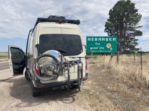
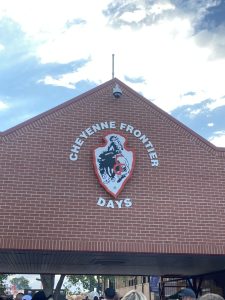
We slept in a small park just off I-80. I got us behind yesterday, so had to make up some time. I started driving around 4am. I had a checklist of things to accomplish around Lincoln. I found some high favorited and Nebraska’s oldest, all by about first light. My wife slept through all of this. Her loss. Then it was time to high tail straight to Cheyenne. We got checked in to our hotel, found the geocache in the parking lot, and learned how to use Uber to get a ride to the Cheyenne Frontier Nights.

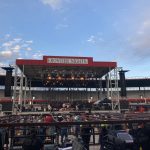
Jason Aldean concert was the first evening we arrived in Cheyenne. Wifey does not like live music, that has been proven several times. But she had a blast at this concert! Not exactly my cup of music, but I had a great time as well. I have always said that I can enjoy almost any live music, and that still proves true. The Rodeo starts tomorrow. This is really shaping up to be the greatest adventure to date.

Day 4

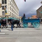
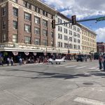
We slept in after a late night at the show last night in Cheyenne. I got up early enough to get ready to head to the Frontier Days parade. It was only about a mile walk from where we are staying. I made a stroll in the morning sunlight to a great corner to watch and photograph the parade. Along the way I did an adventure lab, found at least 1 geocache, hopefully the great earthcache at the sandstone building, and generally loved being me as I wandered sometimes aimlessly. I was able to get some great shots of the parade. I like parades? 67 years young and I just found out I like parades. Shame on me. This afternoon is the first day of the Cheyenne Rodeo, an event not to be missed.

The weather was perfect for a rodeo, and it was a ton of fun.

Day 5

I got up early this morning, before the rest of the town, and my wife. I rode my bike around downtown Cheyenne for several hours, I had the entire place to myself and got in over 17 miles. I found a bunch of geocaches along the way. I did an adventure lab, and I attempted a whereigo. I am terrible at those things. I did a few stages by bike, then the next thing I know, 10 miles? Oh well. Flash forward to the evening. My wife goes to bed and I head north on the interstate to finish this whereigo. Another stage, further north. OK, why not. That has to be it, right? Nope. I go one more, still not the end, I have to head back. I wish there were half points for whereigoesis. Back to Cheyenne.. I meandered through and around the fairgrounds, I did wheelies, and I jumped into puddles. My favorite part is the stopped train along my path. I waited for about a minute. When I determined it was not moving, I crawled under the train, dragging my bike behind me. The people in the cars, stopped at the intersection enjoyed the free show. Then back to my hotel before lunch, and over to day 2 of the rodeo. So much fun, I can’t believe this lucky life I get to live.
So much more has happened. Hope I find time to write about it. No real time to process and post pictures yet. My instantgram is about all there is right now.

Thanks for reading!

St Marys County Maryland, new moon May 2022

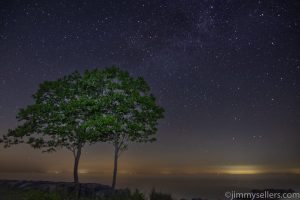
HERE are some pictures of the night sky and sunrise the next morning from Point Lookout State Park in St Marys County Maryland.

I was not planning on going away this particular weekend, definitely not traveling anywhere on the Memorial Day holiday weekend 2022. Then my wife told me she had plans to horse around all weekend, and encouraged me to take a couple of days away in my CAMperVAN. She must have horsin’ around plans with her boyfriend.
I know CAM is over but I just can’t stop myself from continuously Caching Across Maryland.
I happened to notice the other day that Sunday 5/29/2022 was going to be the 10th year anniversary of my first geocache find. My wife and I had heard about geocaching years before, and had done it. But I had never made up an Internet account for it until that day. I left out of Cecil County early Saturday and it took me 14 hours to get 3 hours from home. My favorite kind a road trip. I ended for the evening at Point Lookout on the tip of Maryland to photograph the night sky…new moon. I stopped a lot along the way over 14 hours. I targeted old CAM hides, old in general, FYC, and question marks pre-2010 for a challenge I was working on. Lots of other stuff got in my way as well.
That’s the whole truth. I know it’s true. I made it up myself. And I impart it to you.

Pictures HERE

Tennessee Smokies & Horsin’ Around in Kentucky

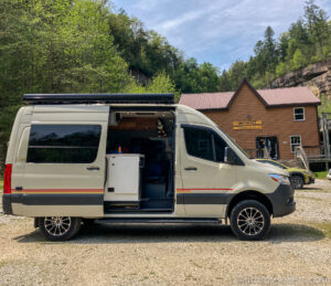
We packed up all our stuff for my wife’s first getaway in my campervan. We started in Lexington Kentucky for some fancy horse dancing event that she loves. It was the Kentucky 3-day 5-star event. A real equestrians dream. In my house we call it Rolex not Rolex. After that went to spend some time in the Smokies.

Day one was spent getting to Western Maryland where we spent the night in a very quiet rest area. A couple of gentlemen in the car next to us were there all night also. I don’t think their wives would have been happy.

Day two was a leisurely morning getting up, followed by driving most of the day to Lexington Kentucky. We made the usual pitstops for tinkling and geocaching. Travel days are great days to fill in calendar dates with unusual types of hides. Throughout the trip I was able to check off question marks and multis during all travel days.

Once we arrived in Lexington the real horsing around fun began. We spent Saturday and Sunday watching horsie jumpers at the horse park. I had much more fun than I imagined. What a fun and unique experience I was lucky enough to experience. In between horse jumpings, I found a bunch of nearby caches. This was definitely a 5-Star weekend for The Kid!

On Monday after the horse event, we climbed all over the Via Ferrata in Kentucky. That is 3 that we have done in the US, with hopes to one day do all the Via Ferrata’s in the US. It was amazing, and definitely the most difficult of the 3 we have done. We spent the night in Compton before heading to Tennessee for a week in the Smokies.

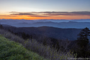
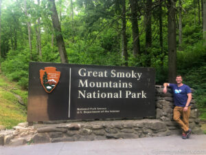
While in Tennessee we did all the perfect tourist stuff. We saw 2 of the shows, ate at the famous places, spent a day in Dollywood, and spent a bunch of time in Smoky National Park. I spent 2 nights in the park in my campervan, taking night time and sunrise pictures, while my wife stayed at the Dollywood hotel. Lucky girl.

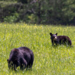
One day we spent driving Cades Cove, and it was amazing! The weather was perfect, and we had 3 different bear spottings. I was finally able to use the widow’s peak on my adventure van for photography purposes! It was a dream come true.

There are a bunch of pictures in a photo album if you click somewhere around HERE.

PA Grand Canyon getaway April 2022

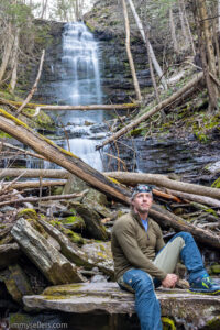
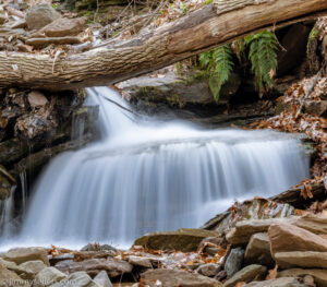
HERE is an album of pictures I took, mostly waterfalls.

Wow! What a great weekend away in my campervan with my best non-geocaching buddy, Chappy. We left home on a Friday morning with a weekend planned at the PA Grand Canyon. It was an amazing weekend of outdoor fun, with an amazing friend, all happening under the umbrella of perfect spring weather. We left Maryland Friday and took our time getting to Leonard Harris state park. This is where we would sleep with each other in my campervan for 2 nights. On the drive up we stopped for some fun sites, a meal, and a few geocaches. Chappy is not a geocacher, but he indulged me in my obsessions.

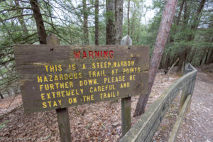
On Saturday, our first full day, we started early with the hike down and back on the east side of the Pine Creek Gorge Turkey Trail. After that, out to the overlooks. I took waterfall photos and am very happy with how some of them turned out. Regroup for a quick snack and then onto bike riding on the Pine Creek rail trail. We did 25 miles total on bikes, just over 12 out and back to where we parked. From the parking we then went another mile north on the rail trail, finding the 3 geocaches from Darling Run parking and north. Chappy is not a geocacher, so he could not care less, but also was very understanding and indulging about my addiction and personal needs. 25 miles of riding my bike, and 3 geocaches. That has to be a record for a geocacher.

After a long day on this side of the creek, we crossed over to Colton State Park. We drove along the creek side road to Chimney Hollow waterfall. I wanted to be here to get some pictures of the waterfall just before sunset. I think they turned out great. We never did find the trail up to the top and simply walk the creek all the way up. We did see a semblance of a trail to get us down 100 times easier. It was quite an adventure just to get some waterfall pictures. Well worth every second.

After this unbelievably fun and adventurous day, it was time for a steak dinner in the nearby town of Wellsboro.

Back to our campsite and a night’s sleep in my camPERVan.

The next morning started lazily with some breakfast and coffee at the campsite. After that we went back across to Colton State Park and walked a bunch of the miles of trails over there. We ran into a Boy Scout pack from New Jersey on the orange trail, and learned all about the possible overnight backpacking options in the future.

Throughout the weekend I found mystery caches and multi caches on days I needed them to fill the calendar. That’s one nice thing about traveling further away from home.

I had a great weekend of fun, excitement and adventure while camping and playing outside with one of my best pals and my favorite thing, my CAMperVAN! 

Catskills New York with a Dog in a Van=Perfection

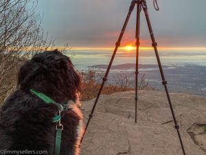
In October 2021 I took my best girlfriend and my new Storyteller Overland Van to the Catskills in New York. Emmy Lou the Puppy was such a trooper. I hope she had a nice time, and wish she had a way to tell me. We set off from home with plans to take sunrise pictures at Overlook Mountain near Woodstock, New York. From there we went further north, and into southern Vermont. We stopped for a  lot of fun geocaches along the way, and played frisbee golf in another new state. If ever there has been a success story, this is it. I took some pictures of sunrises, pictures of our visit to the land of Oz (yes, from the Wizard of Oz), and Emmy Lou being extra pretty.
Interested? Those pictures are HERE.